BY SARAH STEPHENS
ELMORE/AUTAUGA NEWS
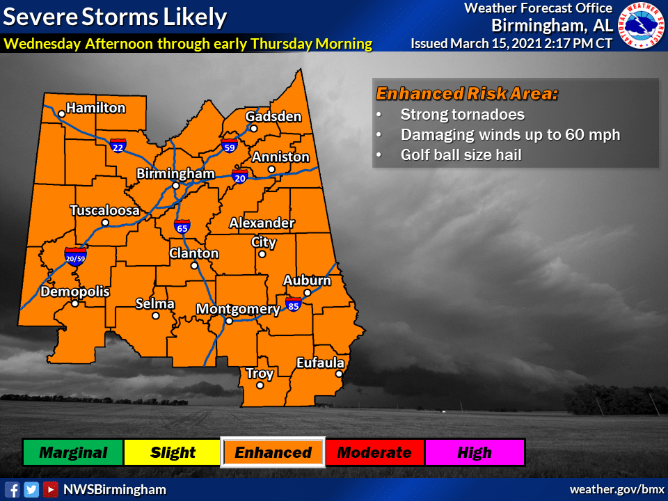
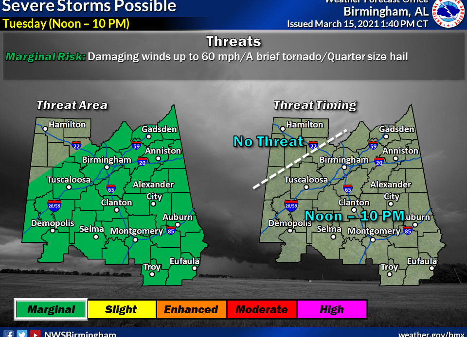
National Weather Forecasters in the country and in the state of Alabama are closely monitoring a system which could impact our area by Wednesday. There is a threat of high winds, tornadoes and large hail, as well as localized flooding after heavy rains.
Area residents are asked to make a plan now, in the event the forecast remains the same and our area takes a hard hit Wednesday into Thursday morning. The time frame for potential storms will be better known by tomorrow, so the EMA will have updates when available.
Keith Barnett is the Elmore County Emergency Management Agency Director. He has been very busy today watching the latest reports, talking to other emergency officials and agencies in preparation.
“Elmore County EMA is preparing for the possibility of severe weather. We will be staying in contact with the National Weather Service of Birmingham to get the most recent updates,” Barnett said. “We want to get the timeframe right. We will be relaying all of that information to all of our stakeholders, officials, schools, hospitals etcetera. Everyone needs to make their plan based on the best information we can give them.”
Barnett continued, “We also have been working with other county agencies, especially the highway department to make preparations should we have severe storms. We need to make sure we have the equipment needed, and personnel and be prepared to respond quickly to get roads cleared. We want to be able to assist volunteer fire departments with moving trees and debris out of roadways if that becomes necessary. We will be coordinating closely with them on all of that.”

Readers who feel they may have to seek shelter in the storms, are reminded about the Elmore County Safer Places program.
“We will be contacting and speaking with our Safer Places. Normally we do not request they be activated until we go under a severe weather watch. Normally the National Weather Service is able to give a two- to three-hour watch time before severe weather arrives. So that is when we activate the Safer Places and push information out to the public,” Barnett said.
For a list of safer places in Elmore County visit the Elmore County EMA website or download the Elmore County EMA App on your smart phone, Barnett said. (Editor’s Note: We shall also be checking with Autauga County for preparations there in a separate article.)
“There is a button on the application to view the Safer Places and which ones are activated,” he added.
For a video of how to use the application on your Smart Phone, Barnett created an information video you can find here – https://www.facebook.com/elmorecoema/videos/712096232809863
“We anticipate being up all night Wednesday through Thursday morning from what we are hearing now. But a lot of this will determine timing. If the NWS starts talking about storms that may pop up ahead of main system, things could change. We hope to know a lot more after tomorrow’s (Tuesday’s) 10 a.m. briefing,” Barnett said.