From US National Weather Service
Birmingham, AL
1/5 3:45 pm: Rain and a few storms into tonight — Some snow flurries on Monday with a slap of cold air arriving and staying for days — End of week system with rain for some, frozen potential for others.
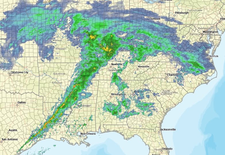
We’ve waves of drizzle and rain showers moving across central Alabama this afternoon. There is a line of heavy rain and thunderstorms to our west, of which will move across our area tonight (image below). The best ingredients for severe storms should remain to our west and we expect this line to be less intense as it moves across central Alabama. Still, it may be able to squeak out a severe storm or two for areas near and west of Interstate 65 between 7 pm and 1 am.
As this system departs the area, wraparound moisture is expected to result in a cloudy day on Monday. There may be enough moisture for some snow flurries or a few light snow showers as cold air spills across the region. It will also be another breezy day, making it feel like the lower 20s. Accumulations, if any, should be minor and limited to grassy or elevated surfaces. In other words, a gasp here and a ooh there, but not shutdown type stuff.
Clear weather is expected around midweek, though we will remain in a very cold weather pattern, with high temperatures in the 30s/40s and low temperatures as cold as the 10s for some.
Thursday night through Friday still has a lot of attention from everyone. Another weather system will skirt across the Gulf Coast region. While we will have a lot of cold air leading up to this system, if it tracks far enough north, it will drag with it air just warm enough such that some will end up with all rain, some a wintry mix changing to rain, with locations farther north seeing all wintry precipitation. The path of this system is critical as are the temperatures at the ground and above our heads. In our part of the country, just a couple degrees up or down makes a huge difference in the forecast. We should be able to pinpoint the details with higher confidence as we get a tad closer.