From the National Weather Service
Birmingham, Alabama
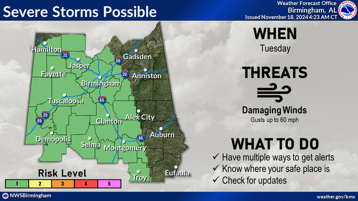
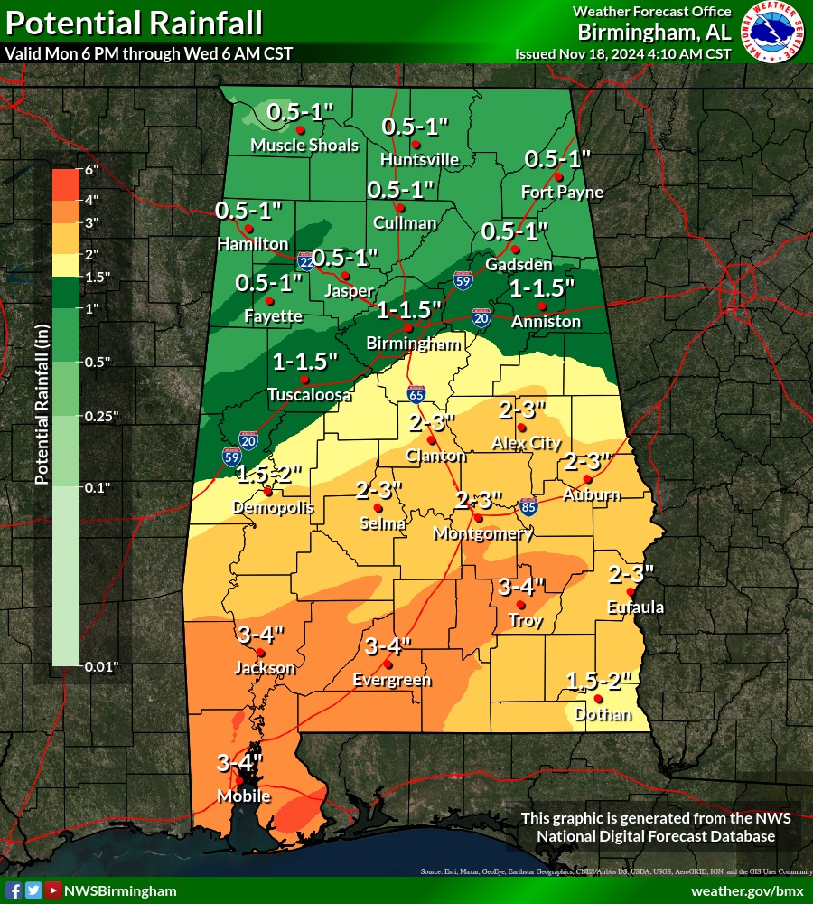
There is a marginal (level 1 of 5) risk for severe storms Tuesday that may produce damaging straight-line winds for much of the western two-thirds of Central Alabama. Rainfall amounts will be generally up to an inch along and north of I-20 with 2-4″ south of Interstate 20.
Today
Partly sunny, with a high near 76. South wind 5 to 10 mph.
Tonight
Showers likely, mainly after 3am. The rain could be heavy at times. Mostly cloudy, with a low around 63. Southeast wind 5 to 10 mph. Chance of precipitation is 70%. New precipitation amounts between a half and three quarters of an inch possible.
Tuesday
Showers, with thunderstorms also possible after 9am. Some of the storms could produce heavy rainfall. Patchy fog before 3pm. High near 70. Southeast wind 10 to 15 mph. Chance of precipitation is 100%. New rainfall amounts between 1 and 2 inches possible.
Tuesday Night
A chance of showers and thunderstorms. Mostly cloudy, with a low around 61. Southeast wind around 5 mph becoming northwest after midnight. Chance of precipitation is 50%.